
Canadian Arctic
Inuit communities are amongst the most remote on earth and inhabit a region that has experienced one of the strongest climate change signals globally. Despite being in a high-income country, health-indicators are similar to middle and low income nations. The IHACC research team has partnered with the community of Rigolet, Nunatsiavut, and has long established contacts, experience, and ongoing projects in this community. Rigolet was also involved in IHACC project development and pilot research.
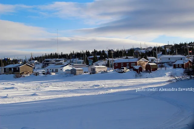
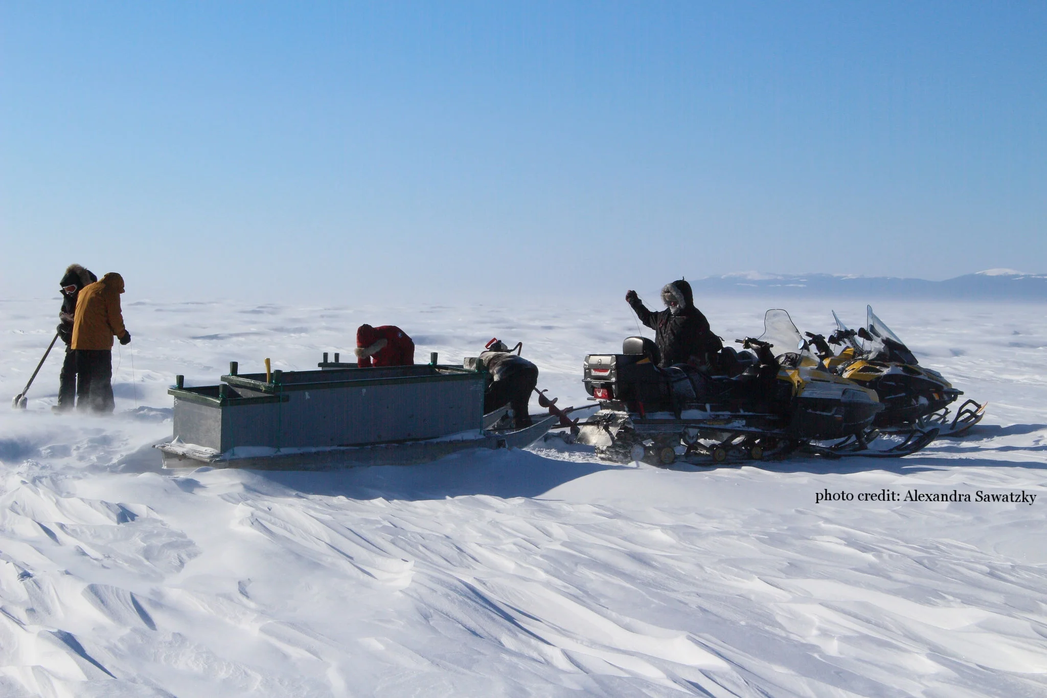
Rigolet, Nunatsiavut, Canada (population: 310)
Before the 18th century, the Nunatsiavut Inuit led nomadic lifestyles in the Hamilton Inlet. When European explorers and trades came, the community of Rigolet was established. Since then, Nunatsiavut land was was claimed by the Labrador Inuit (ratified in 2005) and is self-governed by the Nunatsiavut Government.
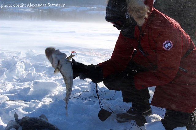
Rigolet is one of five communities in the Nunatsiavut region. Hunting, fishing, and other country foods are harvested for subsistence and are important Inuit cultural practices. However, shifting weather patterns and unstable ice conditions challenges this culture and lifestyle. Rigolet is the most southern Inuit community in the world and is a place where time answers only to the weather and the tides see the town website for more details.
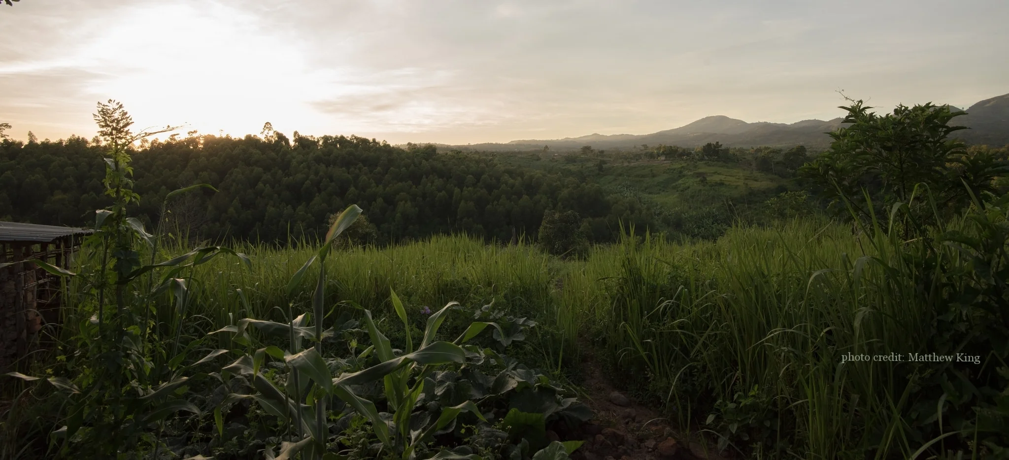
Peruvian Amazon

The Peruvian Amazon is highly diverse both ecologically and ethnically, home to approximately 65 different Indigenous groups. IHACC is currently working with the Shawi of the Loreto region. The team has longstanding research experience with Indigenous communities from this region, and regional Indigenous federations (ORAU, CORPI, FECONASHA, FECONAU) guided community selection. Federation representatives accompanied the research team on introductory visits to four communities, followed by in-depth field research at two communities: Panaillo (Shipibo) and Nuevo Progreso (Shawi).

Nuevo progresso, Loreto, Peru (population: ~350)
Until recently, Nuevo Progreso was a highly isolated community on the Armanayacu River, in the Balsa Puerto District of Loreto. Infrastructure development in the Amazon brought a road to the village in May 2010, exposing the community to rapid changes. Many of the village streams have dried out and villagers have reported increased erosion of river banks since the road was built. Typically not a logging region, the area is beginning to experience increase rates of deforestation.

PERUVIAN RESEARCH PARTNERS:
INTERETHNIC ASSOCIATION FOR THE DEVELOPMENT OF THE PERUVIAN AMAZON · REGIONAL HEALTH DEPARTMENT OF LORETO · ALTO AMAZONAS PROVINCE HEALTH NETWORK
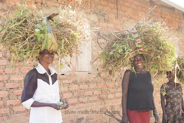
UGANDA: BWINDI IMPENETRABLE FOREST
Indigenous to the Central African equatorial rainforest, the Batwa Pygmy (also known as Abayanda or Twa) are genetically one of the oldest groups in the world. IHACC is working with the Batwa in the highlands of Southwest Uganda, who were evicted from the forest following the creation of Bwindi Impenetrable National Park in 1991. Forced migration to communities near the forest has led to loss of access to traditional foods and remedies, and adjustment to agricultural livelihoods. They experience significantly poorer health outcomes than the Ugandan average. Pilot research was carried out in Mukongoro and Kihembe.

Kihembe (population: 17 households)
Further from the park, Kihembe does not experience the weather near the forest and is also far from Bwindi hospital. As a result, it does not receive some resources like other communities who are near the hospital. There are two primary schools in the area, although some children attend a boarding school further from the settlement. A Church has been constructed in the Kihembe settlement, and there is tank water for the two sections of the settlement.
Bikuto (population: 13 households)
Bikuto settlement is not near the park, so people in this settlement also do not experience the climate in the forest. The settlement is divided into two sections. Children in Bikuto go to Bishops primary school, and the rest go to the nearby school in Butogota. People plant their own food for consumption, and also do other activities for income including basket sewing. The housing in Bikuto has been improved by the Batwa Development Program (BDP) for some members in the settlement.
Mukongoro (population: 17 households)
Mukongoro is surrounded by steep cultivated hills, large banana plantations, and patches of surviving forest. Batwa households are located together at the outskirts of the community. Many Batwa here are originally from the Congo, the border of which is only 1Km away. Mukongoro is in Bwindi and is closer to the hospital. A church constructed by BDP is also located in Mukongoro. People in the settlement plant their own food for both consumption and to sell. Basket weaving and bead making are also made to sell at local tourist markets.
Kitariro (population: 17 households)
This settlement is located near the forest as well as a local health centre. Residents in Kitariro plant their own crops but often have a issues with animals from the forest destroying their crops, so must guard their crops until harvesting time. Many of the children from this settlement go to Bishops primary school.
Byumba (population: 19 households)
Byumba settlement is far from the forest and has a moderate climate. The settlement has a health center, although people are referred to Bwindi Community Hospital in for more serious cases. There is a training center in Byumba which teaches women to sew clothes and uniformsso that they can get an earning.
Karehe (population: 7 households)
Karehe settlement is near the forest. Most people in the settlement do not engage in cultivation as tourism in the area provides income for residents to buy food. Karehe is near the hospital, so there is good access to health and medical services.
Buhoma (population: 3 households)
Buhoma is located in Buhoma town near Bwindi national park and the Bwindi Community Hospital. Buhoma is a small community, although some members of different settlements migrate to Buhoma. People in this settlement cultivate their own food for consumption and to sell.
Ruhangara (population: 9 households)
The settlement is situated along the way to Byumba, although Ruhangara is located a distance from the main road. People in the settlement cultivate their own food and some also produce bricks for selling and building homes. They do not have a nearby health center in their settlement.
Kitahurira (population: 8 households)
Kitahurira is near the park and experiences the forest climate. Each household in the settlement was built with a rain-tank for water collection by an NGO. They also have a well which was built by the IHACC project. Most people plant their own food for consumption but must guard crops against animals from the forest. Distance from the makes it difficult for people to travel to the hospotal for health services.
Kebiremu (population: 21 households)
This settlement is far from the forest and has little land for cultivation; some residents cultivate food in surrounding communities, including Kihembe and Bikuto. Some people in the settlement partake in hired work for food and income. The settlement had a clinic, although it has been closed in recent years, so residents must travel to the Bwindi Community Hospital for services.
UGANDAN RESEARCH PARTNERS:
BATWA DEVELOPMENT PROGRAM
LOCAL KANUNGU DISTRICT GOVERNMENT
BWINDI COMMUNITY HOSPITAL